Wednesday, February 22, 2006
GPS Drawing
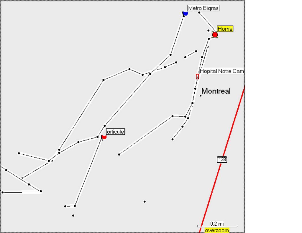
For part of my drawing project, I purchased a handheld GPS system to track my movements across La Belle Province, being drawn as I'm drawing. Below is my first attempt, I basically just turn it on and the satellites find me. Then I start walking around. I've been trying to retrace my steps, marking track points where I have done drawings already. I'm not sure what the little dots are, I think it means I changed direction. Talk about mapping new territory! I'll keep you all posted to my developments. I hope to be able to make a map of all my montreal drawings, as well as attempt a few drawings with the GPS, basically walking around in hopes of making an image that may or may not be representational. Your input is most welcome! :)
Subscribe to:
Post Comments (Atom)
6 comments:
This drawing makes me think of constellations. Anyone into astronomy?
I guess if you planned your trips well, you could make another drawing. This is a cool project, I can't wait to watch it unfold.
This is super cool.
Truly geo-bio-biographical. Makes me think that we do nothing but weave the world into its being.
And combined with blind countour drawing, this is super strong, super strong.
I see Salmon spawning. Fertility.
I see a dove.
I see a g-dKing.
Post a Comment